Update: 6 p.m.
A wildfire that sparked along Highway 3 west of Keremeos is now being held, according to BC Wildfire Service (BCWS).
The Lower Ashnola wildfire is one hectare in size and suspected to be human-caused, according to BCWS.
It is one of two wildfires that sparked west of Keremeos on Friday afternoon.
The other, the Lower Young Creek wildfire, remains 15 hectares in size and "out of control," as of 6 p.m. It is also suspected to be human-caused, BCWS said.
There are no current area restrictions near the blaze, which is located near Cathedral Provincial Park.
Update: 4 p.m.
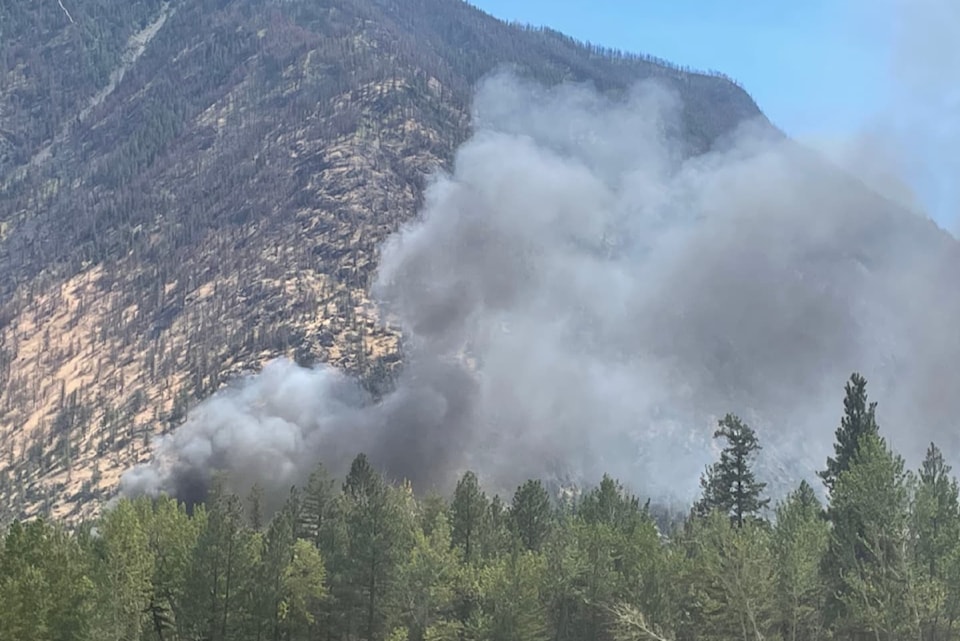
A second wildfire sparked west of Keremeos on Friday, less than 30 minutes after another blaze was discovered along Highway 3 in the area.
BC Wildfire Service (BCWS) says the Lower Young Creek wildfire is 15 hectares in size. It is located near Cathedral Provincial Park.
BCWS officials describe the blaze as "out of control," and its cause is under investigation.
The blaze was discovered after the Lower Ashnola wildfire sparked along Highway 3, just west of Keremeos near the Ashnola River, at around 3 p.m. It is currently one hectare in size.
BCWS, Keremeos Volunteer Fire Department, and Lower Similkameen Indian Band are on scene fighting the blaze.
There are no current area restrictions near either fire. Smoke remains visible from Highway 3.
Original: 3:15 p.m.
Crews are attacking a wildfire that sparked along Highway 3 west of Keremeos.
The Keremeos Volunteer Fire Department is on scene near Ashnola Village on Friday afternoon (July 11), according to the Lower Similkameen Indian Band (LSIB).
BC Wildfire Service (BCWS) says the blaze is "out of control" and 0.009 hectares in size, as of 3:15 p.m.
In a social media post, LSIB said smoke is visible from Highway 3.
"Please stay clear of the scene and let emergency responders do their work safely," its post reads. "Do not stop on the highway to take pictures."
BCWS and AIM Roads are also assisting in fighting the blaze.
There are no current area restrictions near the fire, according to BCWS.
The cause of the fire is under investigation.


